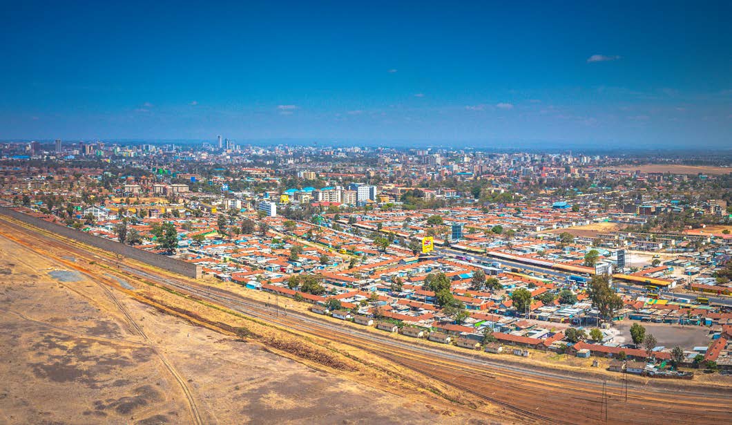
We have a strong presence and expertise in various industries, allowing us to cater to the unique requirements and challenges of each sector, and providing tailored solutions and services to our clients. With a deep understanding of the African market and a commitment to driving sustainable development, EDA strives to make a positive impact in the regions we operate in
AGRICULTURE
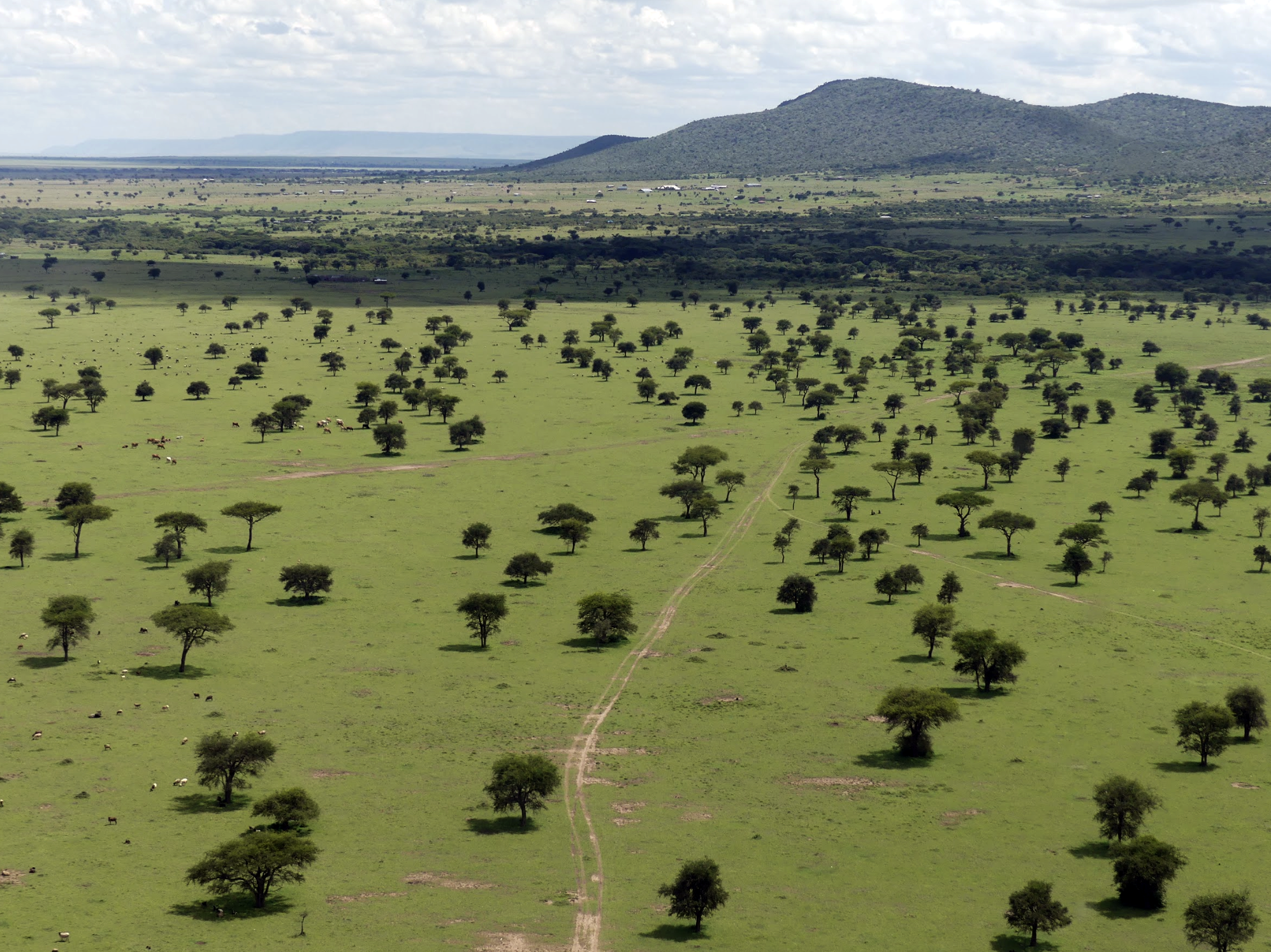
Precision farming is changing the agricultural sector. Aerial data is the pushing force of this change. By inspecting their fields from above, farmers and agronomists can now gain situational awareness with unmatched detail, getting overviews of their fields, forests, or cattle and collecting data much more efficiently than with traditional methods. Gathering and analysing data influences decision-making and improves yield. These processes are now as accurate and efficient as ever due to better software, sensors, and drones
DEFENCE & SECURITY
UAS have become an integral and effective element of defence and security across the world. Examples include:
Thermal and HD RGB video for aerial reconnaissance.
Aerial surveillance with live Thermal and HD RGB video
Automatic object tracking and autonomous object following
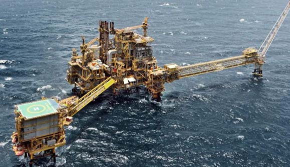
OIL & GAS
In the oil and gas industry, UAS are being used for a variety of applications, including inspection and remote monitoring of offshore platforms, surveying of up to 100 KM of pipeline, and monitoring remote sites at up to 50 KM distance. Flights are autonomous and can fly predefined corridors with automatic terrain following. Detect pipeline defects, leaks, corrosion or frost heave; Monitor remote, offshore or isolated sites; Identify potential hazards to underground pipelines; Monitor ‘Right Of Way’ environments; Record both Thermal and RGB (Red, Green, Blue) video feeds simultaneously with embedded geo-coordinates
AERIAL RECONNAISSANCE
Record up to 100 KM of video, and monitor remote sites up to 50 KM distance, using a high resolution Thermal and RGB camera. Fully autonomous flight plans can fly predefined paths with automatic terrain following.
Monitor thermal signs and assess conditions in disaster areas
Chart and count wildlife activity
Inspect water and flora conditions
Detect illegal deforestation
Monitor sea mammals
Monitor illegal fishing
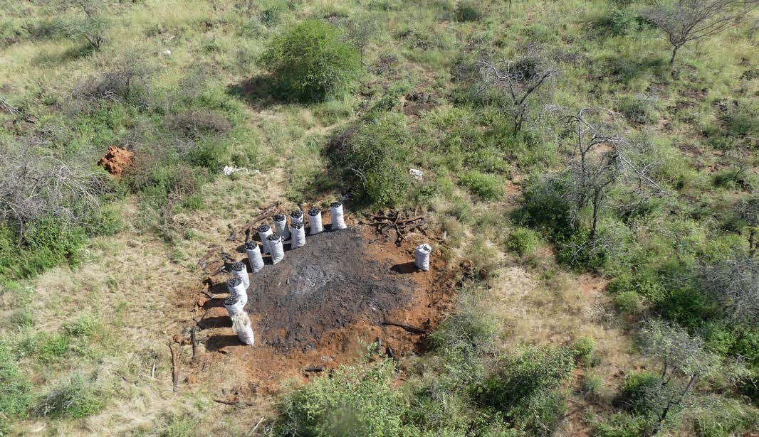
Detect and survey charcoal production sites
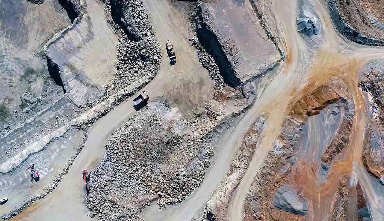
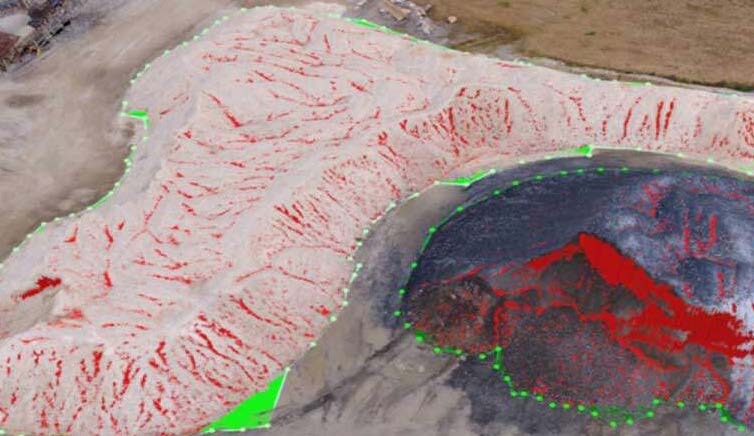
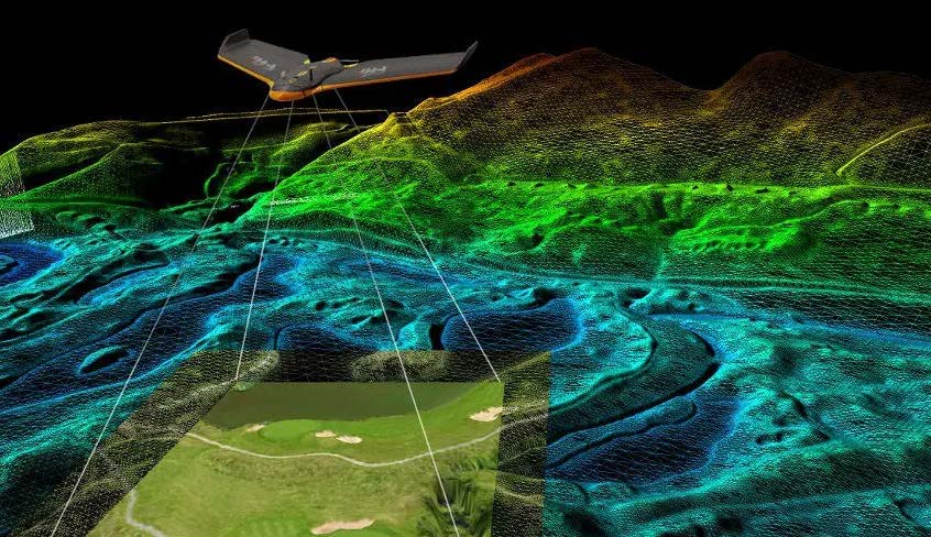
MINING & CONSTRUCTION
Drones delivers centimetre level accurate high resolution geospatial information. Acquire GIS data and imagery from a turn-key drone solutions that can cover large areas and take-off and land anywhere. Drones can survey the indicated area and return for landing completely autonomous.
PERFORM ORTHOMOSAIC MAPPING AND 3D VOLUME CALCULATIONS
Create orthomosaic maps, 3D point clouds and Digital Surface Models (DSMs)
Produce accurate measurements in unreachable areas
Calculate volumes of stockpiles
Create 3D models of quarries and buildings to get accurate data
Chart, plot and plan new mining or construction sites
Process contour lines and elevation profiles
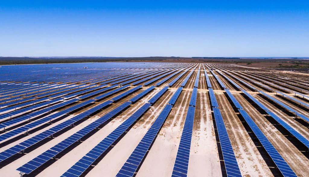
UTILITIES & ENERGY
In the utilities and energy sector – surveying power lines, water pipes or solar panels can be affordably done in a single flights which can cover up to 100 KM. Monitoring remote sites, using high resolution Thermal and RGB video can be fully autonomous and flying predefined corridors with automatic terrain following.
Inspect power lines and isolators
Thermal monitoring of solar panels
Identify potential hazards to underground pipelines
Locate water leaks
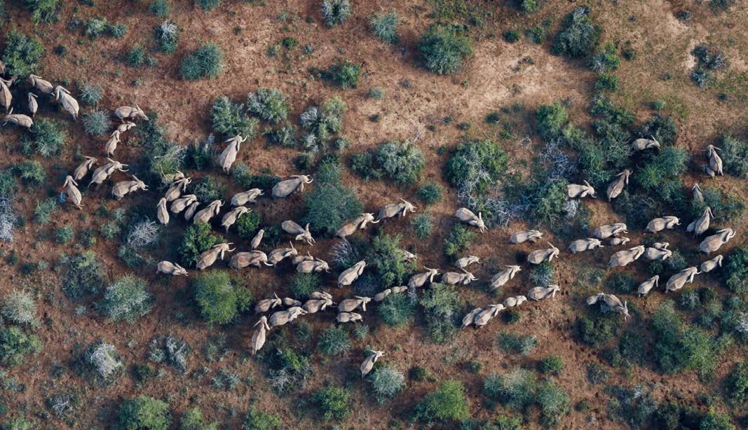
ENVIRONMENTAL & HUMANITARIAN SOLUTIONS
In the environmental and humanitarian sector, UAS are used for good Anti poaching: in particular in detecting humans, cars and camp-fires.
Detect and observe forest fires
Track animals using both RGB and Thermal cameras
Improve ranger safety with aerial reconnaissance in dangerous areas
Using high-definition and thermal video live from a stabilized camera gimbal. While the UAS flies fully autonomous, or guided to areas of interest, a camera operator can move, zoom in and automatically track objects. The video is streamed securely to the ground and recorded for post operation analysis
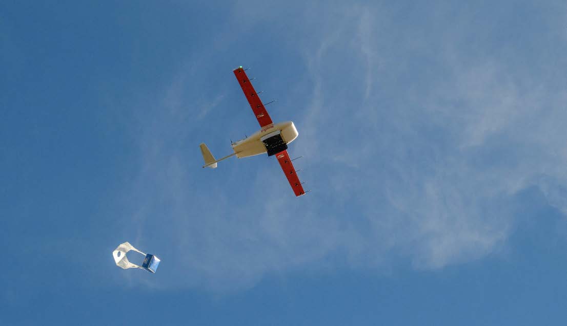
MEDICAL & NUTRITIONAL TRANSPORT
In this sector, medical goods can be delivered to areas in need. Drones systems can carry various payloads and transport them autonomously for up to 50-100 KM. Autonomous missions can take from vertical take-off to vertical landing, even beyond data link ranges. Using payload drop systems, a payload can be attached underneath the drone and dropped at a location between 50 to 100 KM before returning home fully autonomous.
Transportation of blood samples for remote analysis
Drop medical or nutritional aid with a payload drop system
RAILWAYS & ROAD INSPECTION
Drones can survey up to 100 KM of railways or roads in a single flight, and monitor remote sites up to 50 KM distance, using high resolution thermal and RGB video. And they can do this fully autonomously flying predefined corridors with automatic terrain following
GIS & TOPOGRAPHICAL SURVEY
Drones can deliver centimetre level accurate high resolution geospatial information.Acquire GIS data and imagery from a turn-key UAV solution that can cover large areas and take-off and land anywhere. Drones VTOL can take off, survey the indicated area and return for landing completely autonomous
BIOMASS BIODIVERSITY MONITORING
We are a delivery producer of GIS services to clients in the agricultural, conservation, carbon monitoring, natural capital, meteorological and forestry sectors
Nairobi, Kenya | Arusha, Tanzania | Mahe, Seychelles | London, UK | Washington, USA
Training facility: Lemek Conservancy Maasai Mara, Narok, Kenya